In this guide
The Dynamic Physics of Florida Gulf Inlets
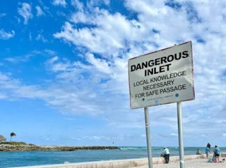
Coastal passes along Florida's Gulf Coast are constantly in motion. Tidal surges, seasonal storms, and longshore drift regularly move thousands of cubic yards of sand across channel mouths, rendering static chartplotter lines outdated between survey cycles. Navigating cuts between barrier islands requires treating digital charts as general guidance rather than absolute real-time truth.
Hydrodynamic forces intensify when a strong outgoing (ebbing) tidal current meets prevailing onshore winds. This opposing wind-against-tide interaction creates steep, tightly spaced standing waves across shallow shoals, turning relatively manageable inlets into hazardous choke points for owner-operators.
Tracking Marker Relocations and Dredging Updates
Official waterway management agencies constantly monitor and adjust aids to navigation (ATONs) across the region. The U.S. Coast Guard publishes the Local Notice to Mariners (LNM) weekly for District 7, providing updates on displaced buoys, temporary channel marker adjustments, and reported shoaling hazards. District 7 also provides an interactive, chart-based map viewer to check voyage-specific notices before untying from the dock.
Dredging operations and channel depth maintenance in regional waterways are coordinated through federal and multi-county entities:
- U.S. Army Corps of Engineers (USACE) Jacksonville District: Responsible for condition hydrographic surveys and maintenance dredging across deep and shallow draft harbors, including Tampa Harbor channels and Clearwater Pass.
- West Coast Inland Navigation District (WCIND): A multi-county special taxing body covering Manatee, Sarasota, Charlotte, and Lee counties that coordinates with the USACE and local governments to fund channel dredging projects, including work in Venice, Phillippi Creek, and New Pass.
| Resource | Publishing Agency | Primary Purpose for Owner-Operators |
|---|---|---|
| Local Notice to Mariners (LNM) | U.S. Coast Guard (District 7) | Weekly updates on marker positions, lighting deficiencies, and hazard alerts |
| Hydrographic Condition Surveys | USACE Jacksonville District | Detailed sounding surveys of federal channels and harbor cuts |
| Regional Navigation Projects | West Coast Inland Navigation District (WCIND) | Local inlet dredging schedules and county waterway maintenance updates |
Reading Real-Time Depth and Visual Water Cues
While lateral aids to navigation (keeping red markers to starboard when returning from sea) define the nominal channel boundaries, sandbars frequently encroach past the markers. Vessel operators must actively combine onboard depth sounders with visual observation of the water's surface.
Pre-Transit Inlet Checklist
- Check the District 7 Local Notice to Mariners for recent ATON discrepancies.
- Verify tide phase to schedule transits during slack water or a rising tide.
- Cross-reference depth sounder readings with charted lateral markers.
- Wear polarized sunglasses to distinguish deeper channel water from shallow sandbars.
- Scan ahead for breaking chop or standing wave crests that indicate shoals.
Inlet Dynamics Around Sarasota and Tampa Bay
Different passes present distinct handling challenges based on their physical contours, infrastructure, and tidal velocity:
- Longboat Pass: Connecting north Sarasota Bay to the Gulf between Anna Maria Island and Longboat Key, this pass features a drawbridge spanning the channel. Navigators must account for cross-currents under the bridge span, particularly during outgoing tides.
- Venice Inlet: Featuring stabilized jetties, Venice provides a direct route to the Gulf, though dynamic currents still require strict attention to lateral markers.
- New Pass & Big Sarasota Pass: Both cuts experience shifting sandbars and periodic dredging operations managed through regional partnerships.
Immediate Actions When Touching Bottom
Maintaining slow, displacement speeds (slow speed, minimum wake) in narrow and unfamiliar cuts minimizes the risk of structural damage if bottom contact occurs. South of Tarpon Springs down toward the Florida Keys, coastal sea bottoms are predominantly sand, meaning a low-speed touch rarely causes catastrophic hull damage if managed calmly.
Zac's Expert Takeaways
Related Seaside Resources
See the yacht makes and models we broker when you are sizing the boat before the dock. See the Dock-to-Deck assessment where we check depth, clearance, and lift capacity against a specific vessel. See the Coastal Insights library for the rest of the series.
Frequently asked questions
Where can Florida boaters find the most recent Coast Guard channel marker updates?
The U.S. Coast Guard publishes the Local Notice to Mariners (LNM) weekly through the Navigation Center website, and Coast Guard District 7 provides an interactive map viewer detailing aids to navigation changes, hazards, and bridge closures.
What is the best tidal stage to run an unfamiliar Florida Gulf pass?
Transiting during a rising (incoming) tide or near slack water is recommended. A rising tide provides increasing water depth if you need to turn around, whereas an ebbing tide can leave a touched vessel stranded on a sandbar as water levels drop.
Who manages dredging for shoaled passes in Manatee and Sarasota counties?
Waterway maintenance and dredging are coordinated regionally through the West Coast Inland Navigation District (WCIND) alongside the U.S. Army Corps of Engineers Jacksonville District and local county governments.